|
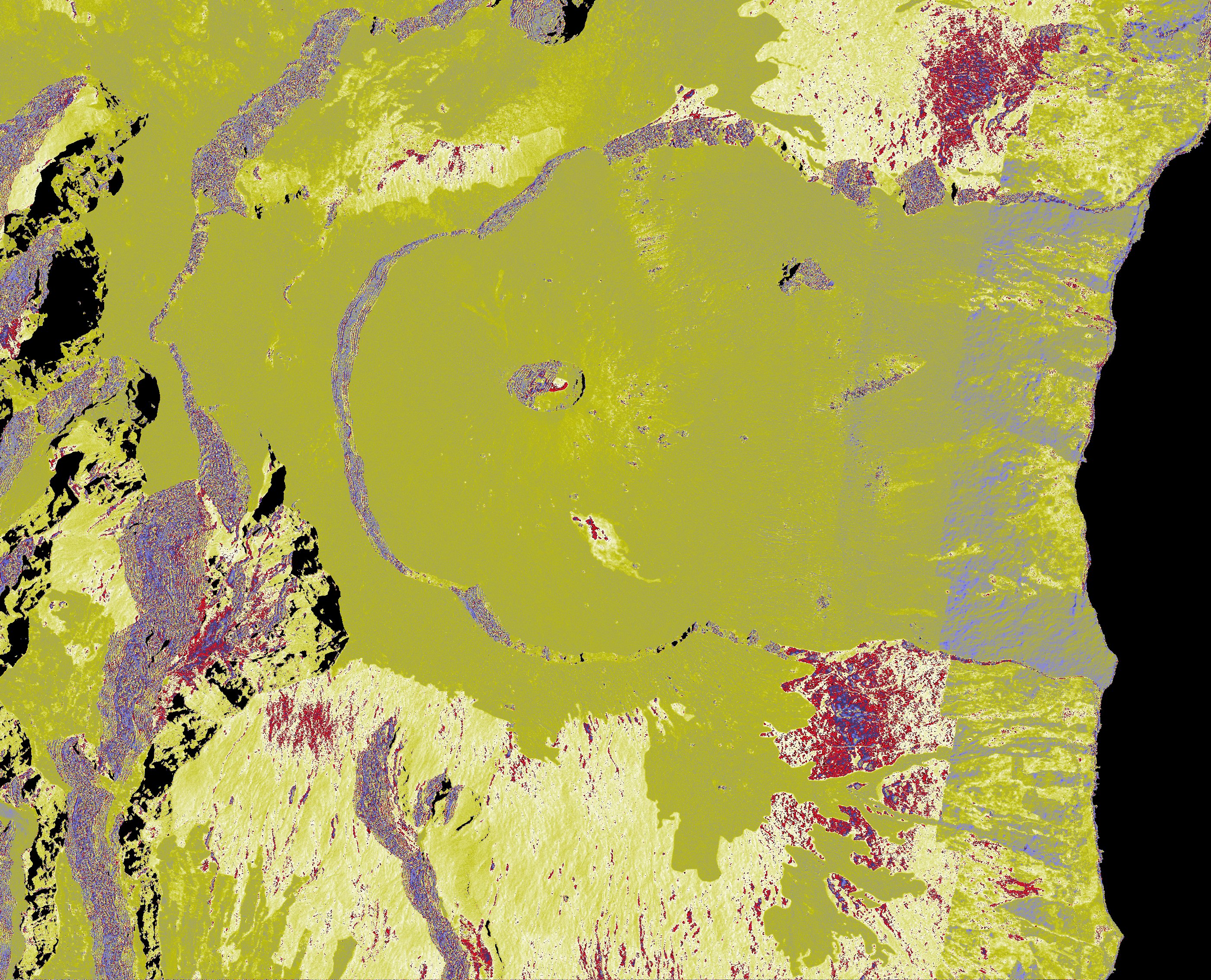
First TanDEM-X Bistatic interferogram of Piton de la Fournaise produced in the framework of the OI2 Observation Service. The master and slave images used to calculate the interferogram were acquired quasi-simultaneously by the TanDEM-X/TerraSAR-X DLR satellites. The data were provided to us by DLR in the framework of XTI_GEOL0224 project. The phase variations recorded on the interferogram mainly reflect elevation differences between the Lidar DEM (IGN 2008-2009) used in the interferometric processing and the real topography at the time of image acquisition in June 2011. One can notice, in Enclos Fouqué, the topographic residues due to the October 2010 and December 2010 lava flows.
|